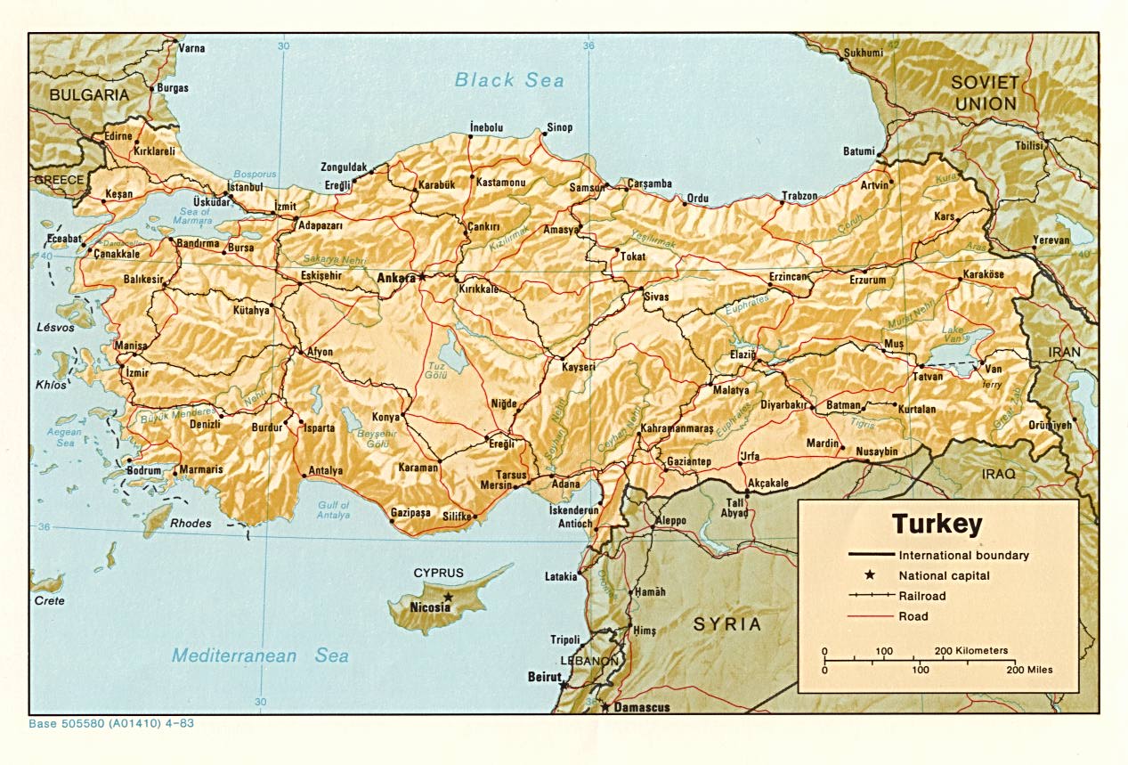
Maps

This page lists all the maps used throughout this website, and a few more.
Openstreetmap & Openrailwaymap
The Turkish railway network is correctly mapped on Openstreetmap. The track layout of the main railway station is also detailed. Openstreet maps is holding more and more details about railway infrastructure like tunnels, bridges, electrification, maximum permitted speed, ...
www.Openrailwaymap.org is a railway oriented rendering of Openstreetmap data.
Openstreetmap is constantly updated and will reflect the current situation on the ground. Unfortunately, Openstreetmap does not keep snapshots of the past for reference.

Openrailwaymap rendering of Turkey.
Modern maps
Overall Turkey
 | Network map, current and disused lines (256Ko), 2018. Updated map with new high speed lines, Kars Tiblissi line & new electifications. |
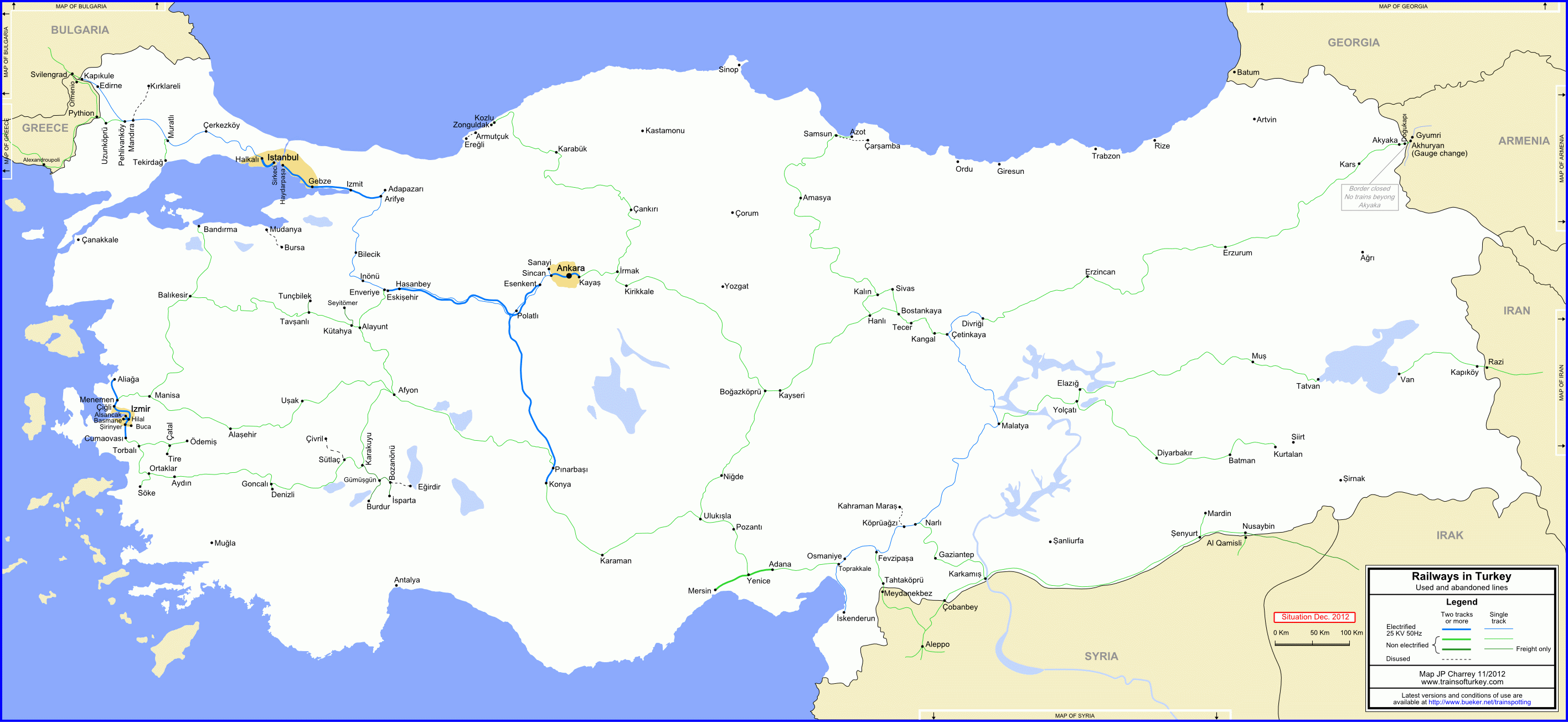 | Network map, current and disused lines (256Ko), 2012. |
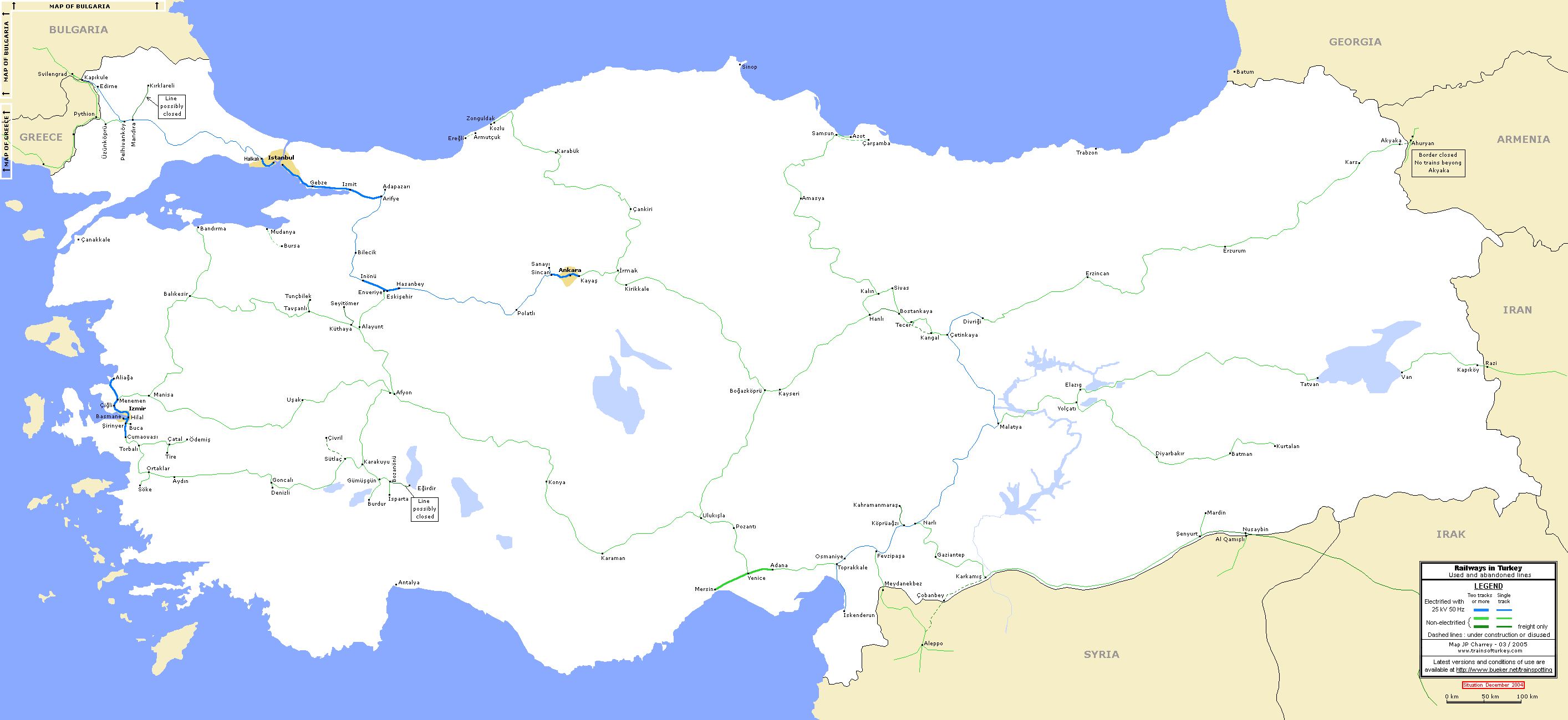 | Network map, active and disused lines in 2004 (60Ko), 2004. This maps indicates TCDD network in 2004, indicating line usage, double vs single track and electrified lines. |
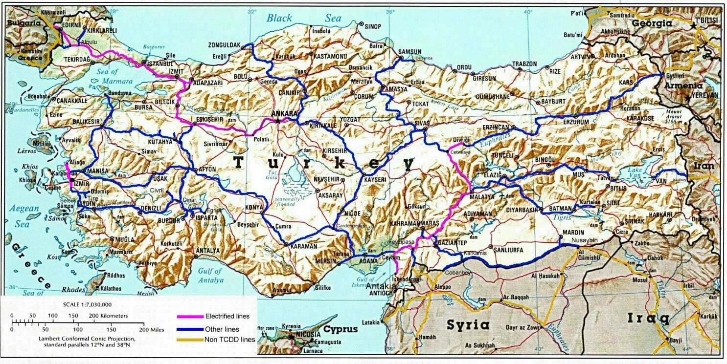 | Geographic map, showing electrified / non electrified lines (800 Ko) This maps indicates the network on a geographic maps with mountains and rivers. |
 | Geographic map, showing railways and main roads network (200 Ko) 2002. |
 | TCDD schematic network map, showing districts (200 Ko) TCDD, 2001. |
Detailled area
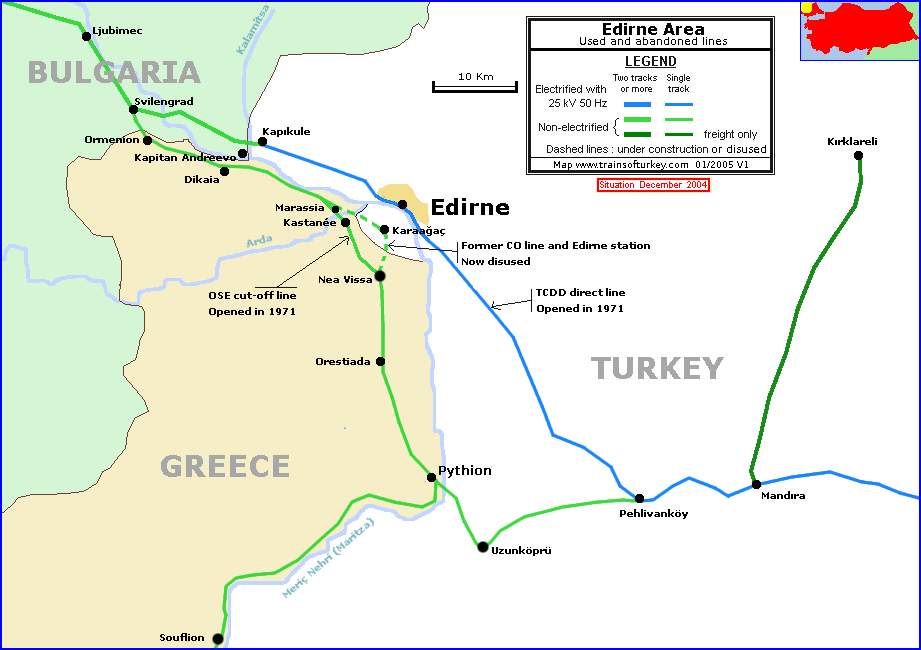 | Edirne area showing Greek and Turkish lines (60 Ko), 2004 Detailed map of the border near Edirne showing former and current location of railway lines. |
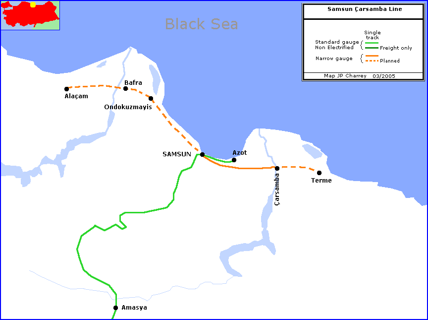 | Samsun area, showing the Samsun Carsamba line (11ko) Map of the narrow gauge line to Carsamba. |
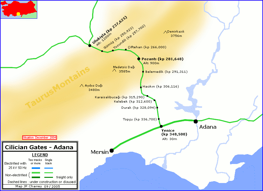 | Cilician gate - Adana, 2004 Showing the pass through the Taurus range. |
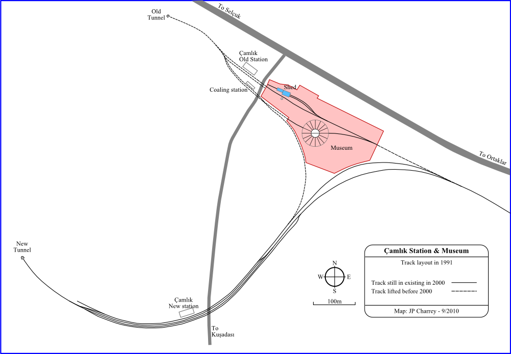 | Camlik Station and museum in 1991 Showing the museum location over the disused station |
 | Map showing the location of Alsancak station, Basmane station, Hilal and port in 2012 |
Old maps
Turkey
The most interesting value about these maps is to look at all the intended lines at the time and compare with the actual situation. It also worth to note that some lines have been in planning stage throughout the century without being built yet.
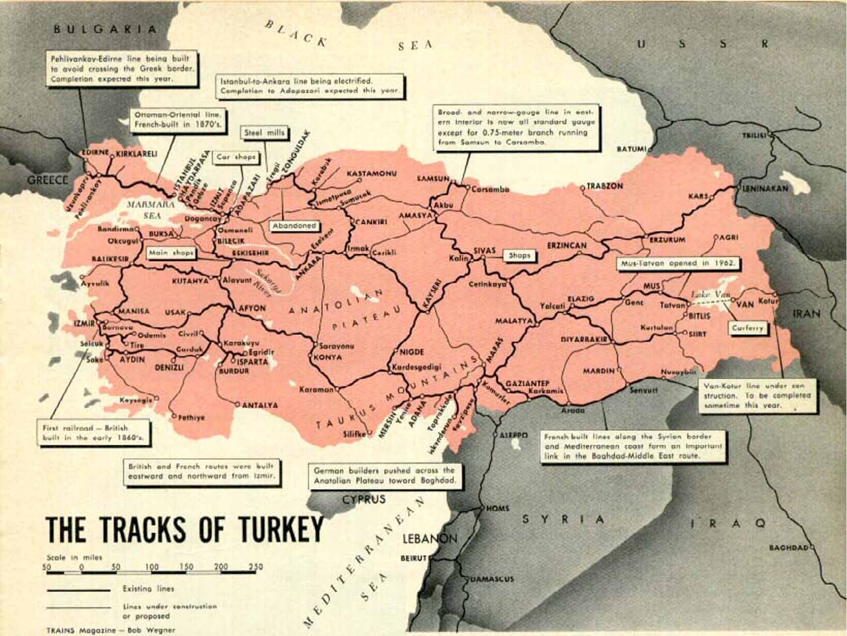 | Turkey, Railways in 1970 (330 Ko) Trains Magazine, April 1970, page 27. It shows lots of quite unusual projected lines such as a link Trabzon Erzurun. It is certainly an all-time winner: a dream were all large roads are converted to rails! |
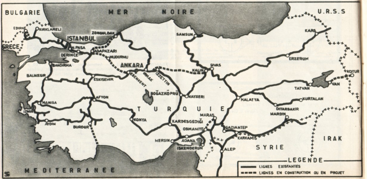 | Turkey, Railways in 1968 (170Ko) La Vie du Rail, 28 April 1968, page 14 This map has the usual lot of "projected" lines. |
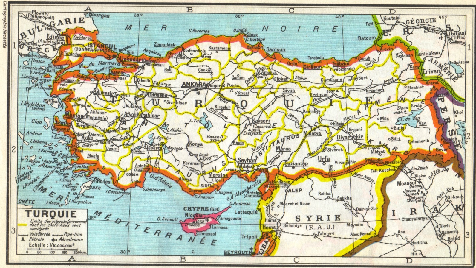 | Turkey, Railways in 1956 (538Ko) "Atlas Hachette, le tour du monde en 180 cartes", Hachette, 1956, p44 A beautifully colored map, with no projected lines. Sign of times: this maps includes Cyprus and its railway. Some branch lines such as Elazig or Kirklareli are missing. |
 | Turkey, Railways in 1941 (270 Ko) "La politique ferroviaire en Turquie", Direction Générale de la Presse; 1941 This map indicates four unusual projected lines: Bandirma to Canakkale, Karakuyu to Cumra via Beysehir, Sumucak to Erzurum via Amasya (sic) and finally Tercan to Mus. |
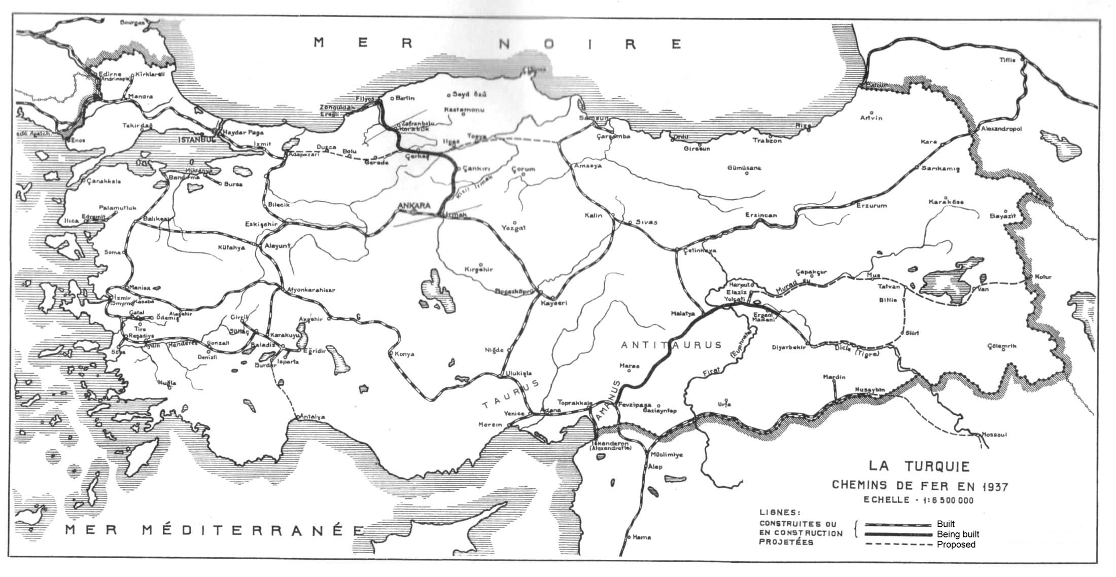 | Turkey, Railways in 1937 (430 Ko) "Construction des lignes de Chemins De Fer Irmak - Filyos & Fevzipasa - Diyarbekir", Groupe Suedo - Danois; Goteborg & Copenhague: Nydquist & Holm. |
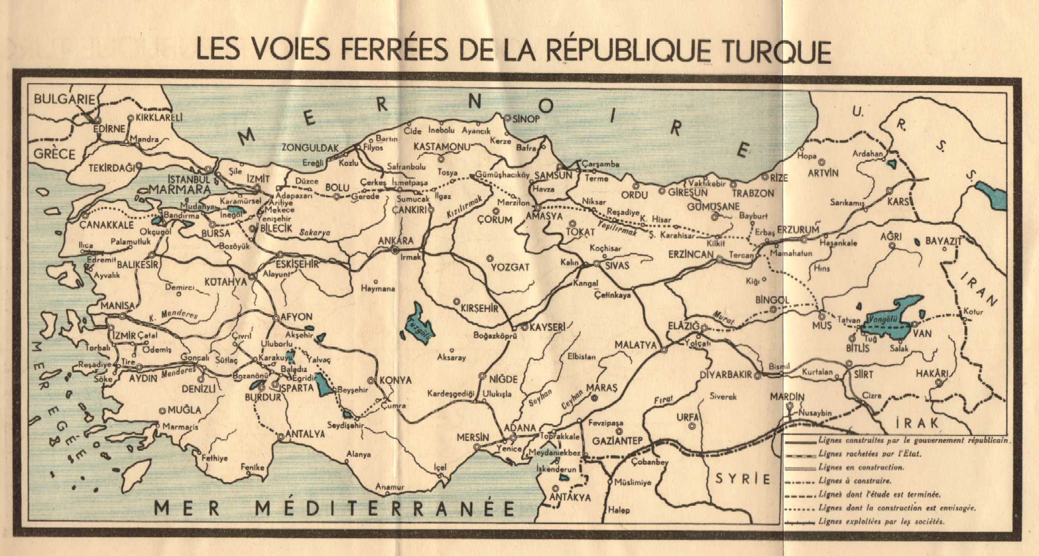
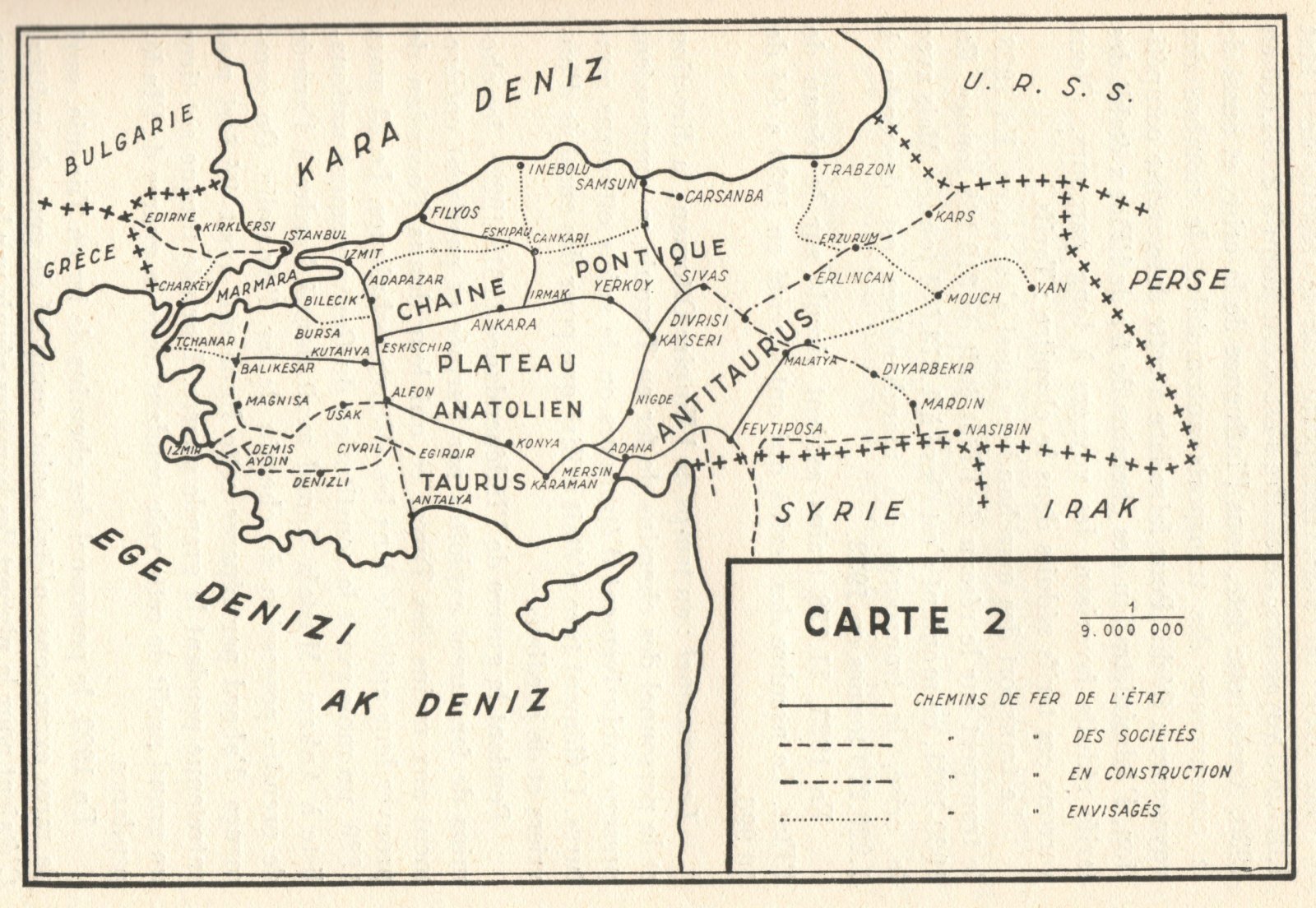 | Turkey, Railways in 1933 (315 Ko) "Les chemins de Fer en Turquie et la politique ferroviaire turque", Orhan Conker, p87 This map indicates many projected lines, including one to Canakale and a Erzurum Mus connection. |
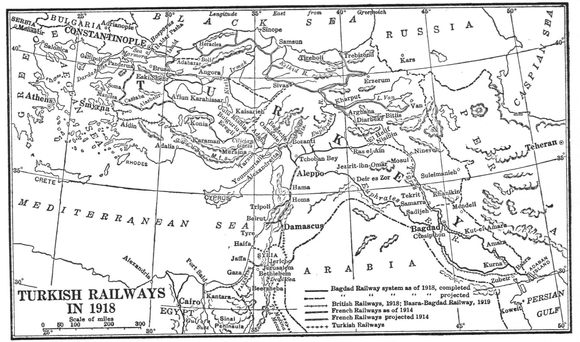 | Turkey, Railways in 1918 (260 Ko) |
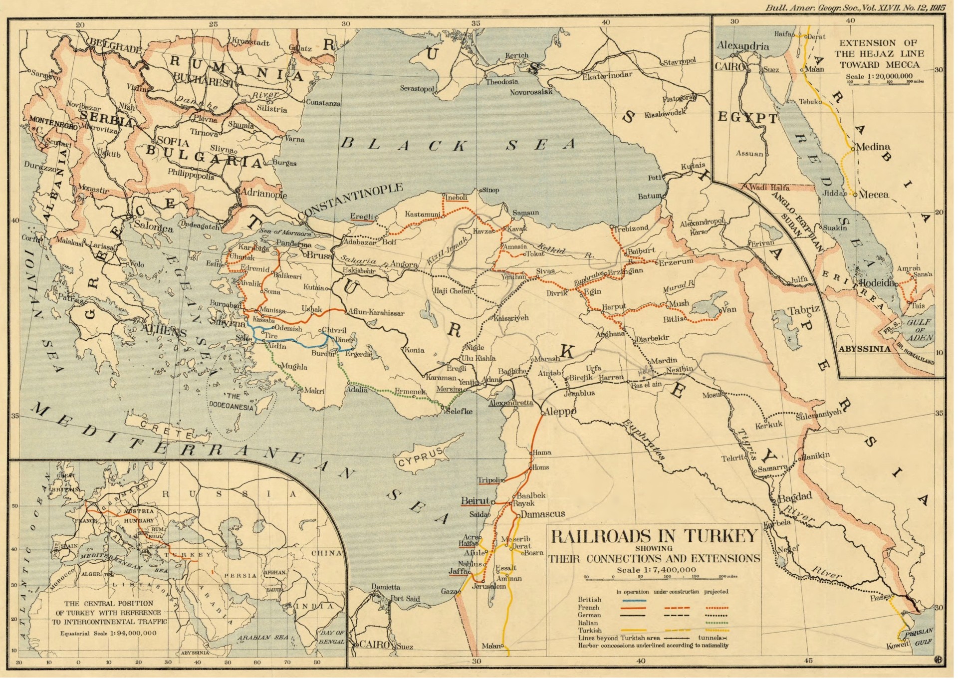 | Turkey, Railways in 1915, American Geographical Society collection (750Ko) |
Istanbul
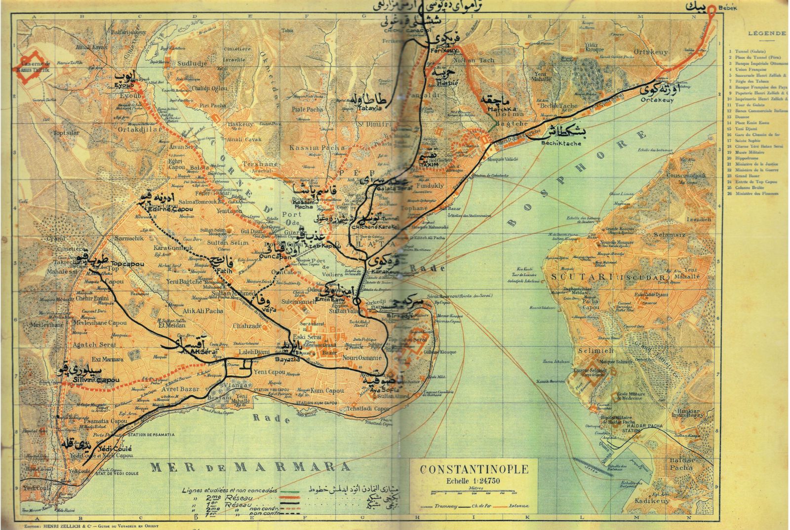 | Istanbul tram map (492 Ko) "Guide du Voyageur en Orient", Ed Henri Zellich & Cie, 1925 |
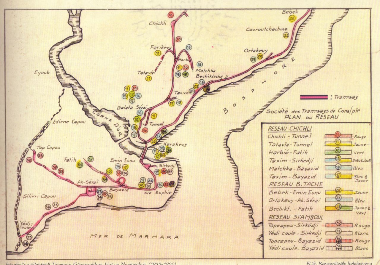 | Istanbul tram map (197 Ko) "Plan du réseau, Société des Tramways de Constantinople", 1920 |
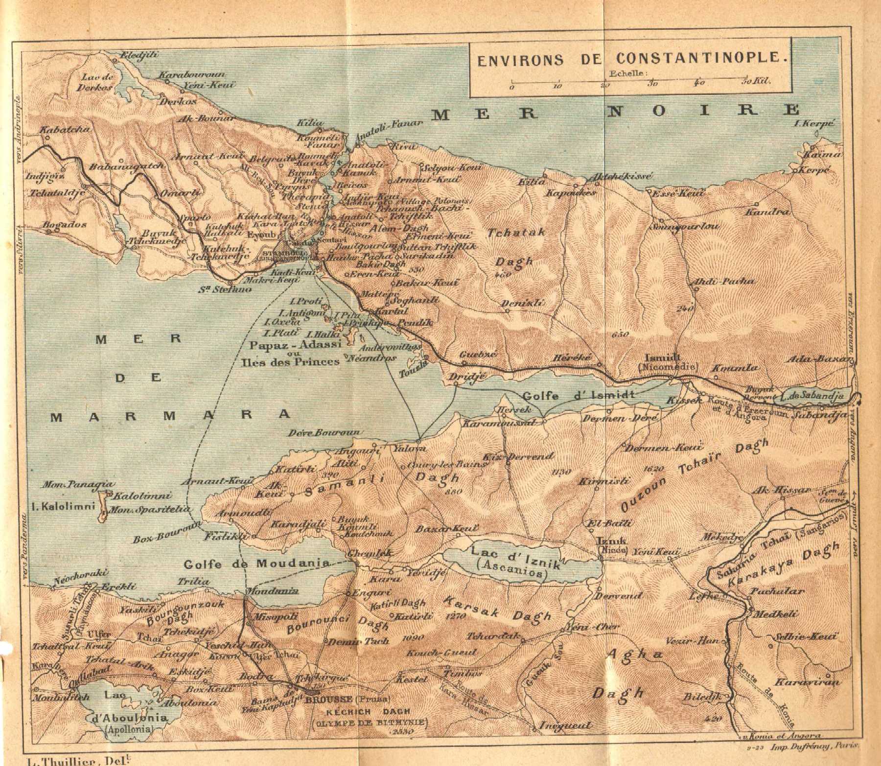 | Constantinople area and Marmara coast (460 Ko) 1911, "De Paris à Constantinople, les Guides Bleus" Hachette, |
Other
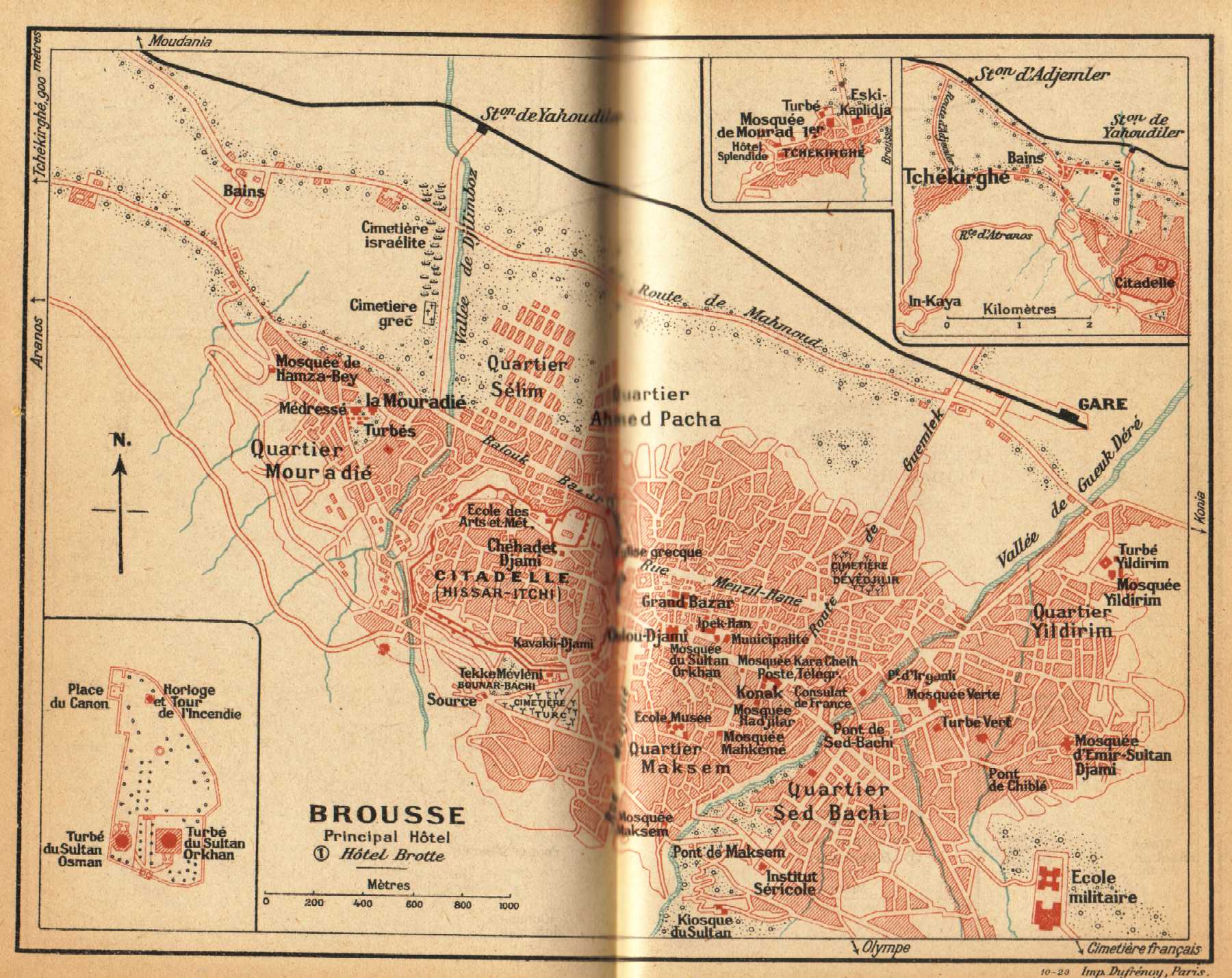 | Bursa, 1911 (350 Ko) 1911, "De Paris à Constantinople, les Guides Bleus" Hachette |
Sketch maps
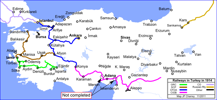 | Railway development in Turkey in 1914 (107Ko) |
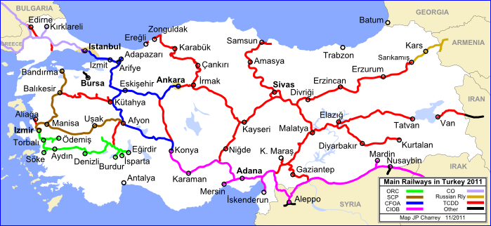 | Railway development in Turkey in 2011 (134Ko) |
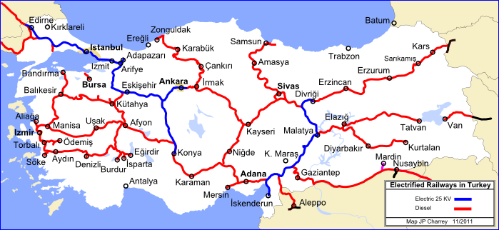 | Electric vs non electric lines in Turkey 2011 (125Ko) |
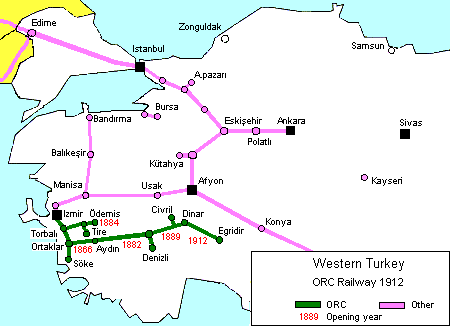 | Western Turkey, ORC Lines in 1912 (15Ko) Opening dates of ORC lines |
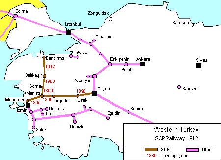 | Western Turkey, SCP lines in 1912 (15Ko) Opening date of SCP lines |
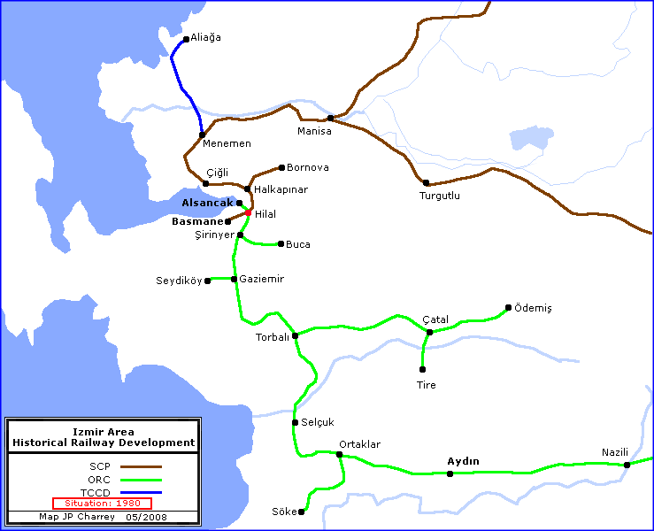 | Izmir area, final railway development (15Ko) |
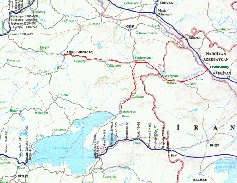 | Eastern Turkey and the possible route of Russian miliary railway near Dogubayazit, the route is in red (180ko) Route drawn by JP Charrey on an extract of a TCDD map |
Stations Strack layout
                               |